Marine GPS and Chartplotter Basics

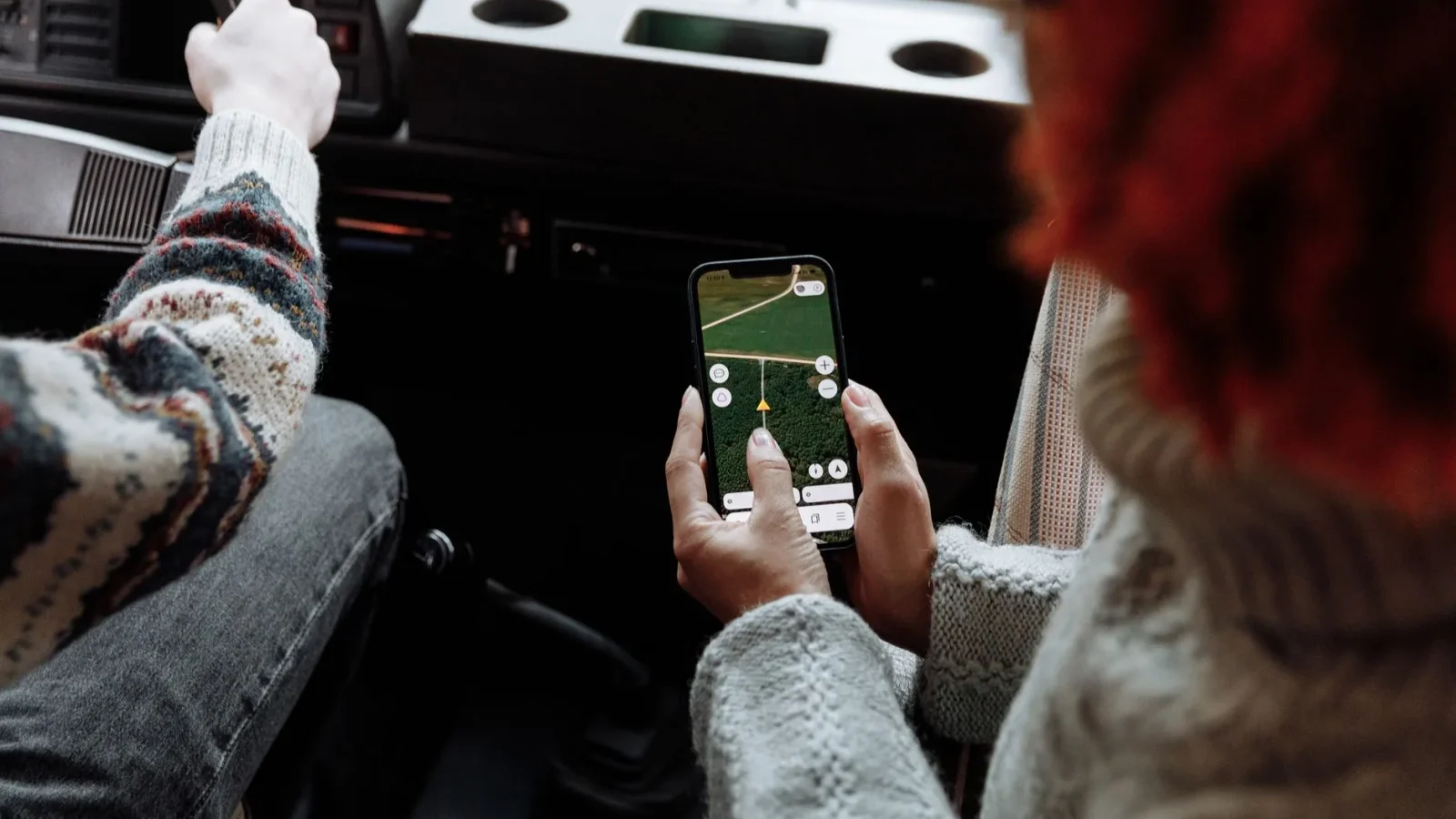
The first time your phone loses signal three miles offshore, you understand why a dedicated navigation box still lives on the helm. Your phone map goes blank and grey. The chartplotter next to it keeps drawing your boat crawling across the same nautical chart it was showing five minutes ago, because it never needed a cell tower in the first place.
That difference confuses a lot of new boat owners. A phone knows where you are; so does a chartplotter. But one depends on a network that quits at the breakwater, and the other listens to satellites that cover the whole ocean. Understanding why is the fastest way to feel comfortable with the screen on your dash.
This is the plain-language primer I wish someone had handed me before I ever touched a helm.
What GPS actually is
GPS stands for Global Positioning System, a constellation of satellites run by the U.S. government that broadcast timing signals from about 12,500 miles up. Your receiver listens to several of them at once, measures how long each signal took to arrive, and does the math to fix your position.
To pin a spot on the earth, the receiver needs a clear line to at least four satellites. With that it can calculate latitude, longitude, and a rough altitude, then update the whole thing several times a second as you move.
Here is the part people miss. GPS is receive-only. Your boat does not transmit anything to the satellites, and there is no monthly fee, no SIM card, and no coverage map that ends at the horizon. If the sky is open, you get a fix. You can read the technical background straight from the official source at gps.gov.
Why offshore accuracy is better than you think
Out on open water, a modern receiver is usually accurate to within 3 to 5 meters, sometimes tighter. There are no buildings or canyon walls to bounce the signal around, which is exactly the multipath problem that makes your phone jump around downtown.
A boat I rewired last spring had the owner convinced his old plotter was broken because it showed him “50 feet off the dock.” The unit was fine. The 2003 antenna was slow and the chart datum was outdated. A $90 modern antenna put him right back on the pier.

What a chartplotter adds
GPS alone gives you numbers: a latitude and a longitude. Useful, but not something you can steer by at a glance. A chartplotter takes that position and paints it onto an electronic nautical chart, so instead of coordinates you see your boat as an icon moving across a map of the water.
That map shows depth contours, buoys, marked hazards, channel markers, marinas, and the shoreline. Your position sits right on top of it, updating in real time. Now “where am I” becomes “I’m in the channel, 200 feet from the red buoy, in 14 feet of water.”
The plotter also remembers things. It stores waypoints (saved spots you want to return to, like a good anchorage or a reef), draws a breadcrumb track of where you have already been, and links waypoints into a route you can follow turn by turn.
Charts are the part that actually matters
Here is the mistake I see most weekends: someone spends $700 on a beautiful screen and never loads a proper chart for their area. The unit ships with a low-detail base map that is fine for a general shape of the coast and useless for threading a shallow inlet.
Detailed charts come from a handful of makers (Navionics and C-MAP are the big two) and load either on a small memory card or as a download. They cost roughly $100 to $250 per region and get updated as buoys move and shoals shift.
The underlying survey data often traces back to public sources like NOAA, then gets packaged with extra features like aerial imagery, sonar-logged depth shading, and community-shared tracks. Match the chart brand to your unit before you buy; a C-MAP card will not run on a plotter built for Navionics.
Standalone plotter or a combo?
Most units on the shelf today are actually combos: they run GPS charting and sonar on the same screen, usually split down the middle. If you fish at all, the combo is almost always the smarter buy, and I break down that decision in detail in our guide to Chartplotter vs Fish Finder Combos.
A pure chartplotter with no sonar still makes sense for sailors and cruisers who never fish and want every pixel devoted to the chart. For everyone else, adding sonar costs little and earns its keep. If sonar performance is your priority, start with our walkthrough on How to Choose a Fish Finder.
| Factor | Standalone chartplotter | Chartplotter/sonar combo |
|---|---|---|
| Main job | Navigation only | Navigation plus sonar |
| Typical price | $300 to $900 | $400 to $1,200 |
| Extra wiring | Power and GPS antenna | Power, antenna, transducer |
| Current draw | 0.5 to 1.5 A | 1 to 2.5 A |
| Best for | Cruisers, sailors | Most weekenders and anglers |
Screen size, antennas, and what to actually buy
For a trailer boat or small cruiser, a 7-inch to 9-inch screen is the honest sweet spot. Smaller than 7 inches and a split screen gets cramped; larger than 9 inches and you are into flush-mount dashes and bigger budgets. A 9-inch unit reads well in daylight from the wheel of a 22-foot center console.
Most units have the GPS antenna built into the housing, which is fine if the helm has open sky above it. If your unit sits under a hardtop or a lot of metal, add an external antenna puck (about $80 to $150) and mount it up high where it can see the sky.
Networking for later
Look for a unit with NMEA 2000 support, a marine data network (think of it as a plug-and-play backbone for your electronics). It lets the plotter share data with a VHF radio, an autopilot, engine gauges, or a wind sensor down the road. It is the difference between one smart screen and a helm that talks to itself.
Wiring it in without headaches
The good news is that a marine gps chartplotter is a light electrical load. Even a big combo pulls only 1 to 2.5 amps at 12 volts, which is less than a single cabin light. That does not mean you can splice it into the nearest wire and forget it.
Give the unit its own circuit fed from the panel, protected with a 3-amp or 5-amp fuse and run in 16-gauge marine-grade tinned wire. Sharing a circuit with bilge pumps or livewell pumps pushes electrical noise onto the line, and that noise shows up as sonar static or a jumpy GPS position.
Keep every connection out of the “good enough” pile. Marine tinned wire, adhesive-lined heat-shrink crimps, and a fuse close to the power source are the standards laid out by the American Boat and Yacht Council. For the full sequence of power runs, fusing, and grounding, our Marine Electronics Setup Guide walks through the whole helm.
How the pieces fit on your boat
Picture it as three simple parts. The satellites give you a position, the antenna receives it, and the plotter draws that position on a chart you loaded for your waters. Everything else, the waypoints, the routes, the sonar, hangs off that spine.
If you are wiring a full helm from scratch, sequence it sensibly: sort your power and battery first (a stable 12V feed makes every screen behave, which is one more reason to consider a Lithium Boat Battery Upgrade Guide if your bank is tired), then the plotter, then the safety gear like a properly installed VHF. Speaking of which, tying your plotter to the radio so it can send your exact position in a mayday is one of the best reasons to read up on Installing a Marine VHF Radio.
Get those fundamentals right and the screen stops being intimidating. It becomes what it should be: the most trustworthy thing on the dash when the fog closes in and your phone gives up.
Frequently asked questions
What is the difference between GPS and a chartplotter?
GPS is the satellite system that tells your receiver where it is as a latitude and longitude. A chartplotter takes that position and draws it onto an electronic nautical chart, so you see your boat moving across a map with depths, buoys, and hazards. In short, GPS finds you and the chartplotter shows you in context.
Do I need to pay a subscription to use a marine GPS chartplotter?
No. GPS itself is free and requires no SIM card or cell signal, since your unit only receives satellite signals. You do buy detailed charts once, usually $100 to $250 per region, and you may pay for occasional chart updates. There is no mandatory monthly fee to keep the unit working.
What size chartplotter screen should I get?
For a trailer boat or small cruiser, a 7-inch to 9-inch screen is the practical sweet spot. Smaller screens feel cramped once you split them between chart and sonar, while larger flush-mount units cost more and need a bigger dash. A 9-inch unit reads clearly in daylight from the wheel of a 22-foot boat.
How much power does a chartplotter draw and how should I wire it?
Most units draw only 0.5 to 2.5 amps at 12 volts, a very light load. Give it a dedicated circuit with a 3-amp or 5-amp fuse and 16-gauge marine tinned wire, with the fuse mounted close to the power source. Keeping it off pump circuits prevents electrical noise that shows up as sonar static or a jumpy position.
Can I trust the chartplotter chart completely?
Treat the chart as a strong reference, not gospel. Buoys drag, sandbars shift after storms, and no card updates the instant the water changes. Keep a paper chart aboard as backup and trust your depth sounder over the screen whenever the two disagree.